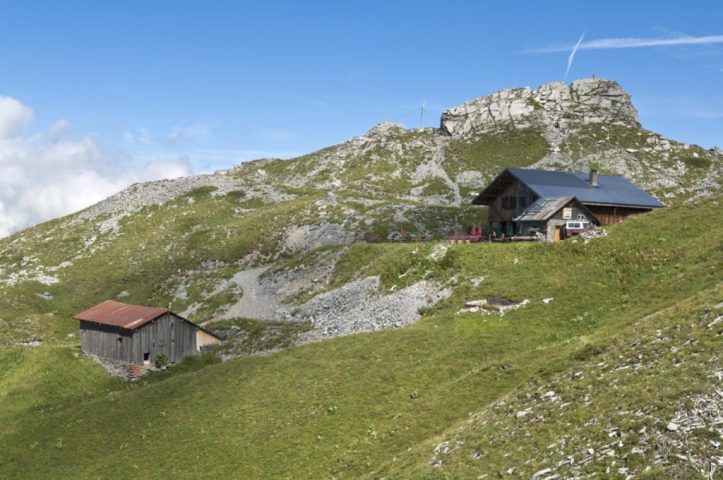
Discover the Grenairon Refuge and its beautiful views over the Fiz mountains and the Anterne valley. The refuge is an important stopping point for hikers on their way to the top of Mont Buet (3,100 metres), the highest mountain of Sixt-Fer-à-Cheval.
Whatever your hike, remember to pack cereal bars, plenty of water, sunglasses, sunscreen, a small first-aid kit, and clothing appropriate to the season and weather forecast.
Comforts
Services
- Pets welcome
- Accommodation
- Restaurant
- Pets allowed on leash only
Furniture
- Free car park
- Car park
Accessibility
- Not accessible in a wheelchair
Itinerary
- Distance: 12.5 km
- Duration: 5h30
- Type of land: Stone, Ground, Not suitable for strollers
- Markup: Departmental signposting on beige metal panels with green lettering.
- Maximum altitude: 2000 m
- Elevation: 1078 m
- Vertical drop: 1078 m
- Positive elevation: 1078 m
Services provided
Visits
- Group visit duration: 330 min
Prices
Free access.
Opening
From 15/06 to 30/09 daily.
Subject to favorable snow and weather conditions.
Subject to favorable weather
This service provider also proposes
Complementary services
Guidebook with maps/step-by-step


